Corsica GR20 Trek - September 2016
The GR20 was my first long distance trek (and I say this loosely as it’s more up and down than long distance, around 11,000m of ascent over 180km makes for some pretty steep terrain). I’d paddled and hiked in Corsica in April 2015 and immediately been taken by the beautiful rocky spires and ridgelines. I knew it was somewhere I’d need to come back to.
My attempts at mountaineering on that previous trip had failed. I’d flown out a day or two of the paddling trip (which was travelling down by road) and decided to give a mountain climb a go. Unfortunately I’d travelled out in mountain trainers and with only hand luggage. Being part of the Mediterranean I’d assumed Corsica would be warm and a two day mountain route would be easy. As such I hadn’t really researched the route, instead just buying a map and renting a car once in country. This turned out to be a mistake – my drive in on the planned route was blocked by snow and after a very cold bivvy I turned round the following morning without completing my ascent.
Thankfully our GR20 was much more successful. There is a lot of hype on the internet about the GR20 being “the toughest long distance trail in Europe”. Don’t let this put you off – the GR20 is definitely do-able for a prepared and fit group. The ‘Logistics’ section contains information that may help you decide if this trek is for you.
Our trip started slowly as we struggled to find gas canisters. We’d flown out on a Sunday (more due to the availability of cheap flights than anything else) and couldn’t find any canisters at the SPAR just off the T30 road past the Tankstelle VITO train station. The supermarket in Calenzana was shut by the time we arrived and so we sat down for a late lunch while we considered what to do. Almost immediately an intense rain and thunderstorm started (although luckily an awfully nice lady offered us shelter under her porch and then brought us out tea and coffee). I’d heard all about the mid-afternoon thunderstorms of the GR20 and resigned myself to the fact that this is what we were going to have to deal with whilst trekking – thankfully this was by far the worst weather we encountered over the two months!
The night didn’t go well either. Emily’s brand new ultra-expensive lightweight Lightwave tent just didn’t work. After struggling for about 30 minutes to put it up, and even resorting to the instructions, we gave up. Fortunately I’d had a decent repair kit with me and we were able to remove one of the sections from each of the geodesic poles – the tent now went up but sat on a bit of a camber and just looked odd! Emily had managed to get this tent up once in the UK but she reported it was very difficult – I’m 95% certain we weren’t doing anything wrong and that the tent materials had somehow contracted (from heat or humidity???) making it impossible to fit the poles in.
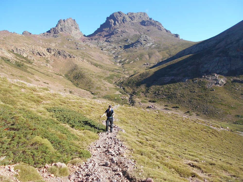
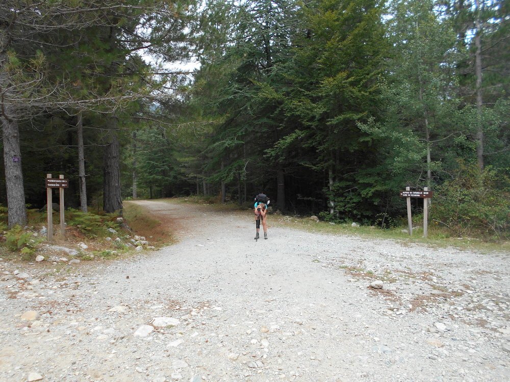
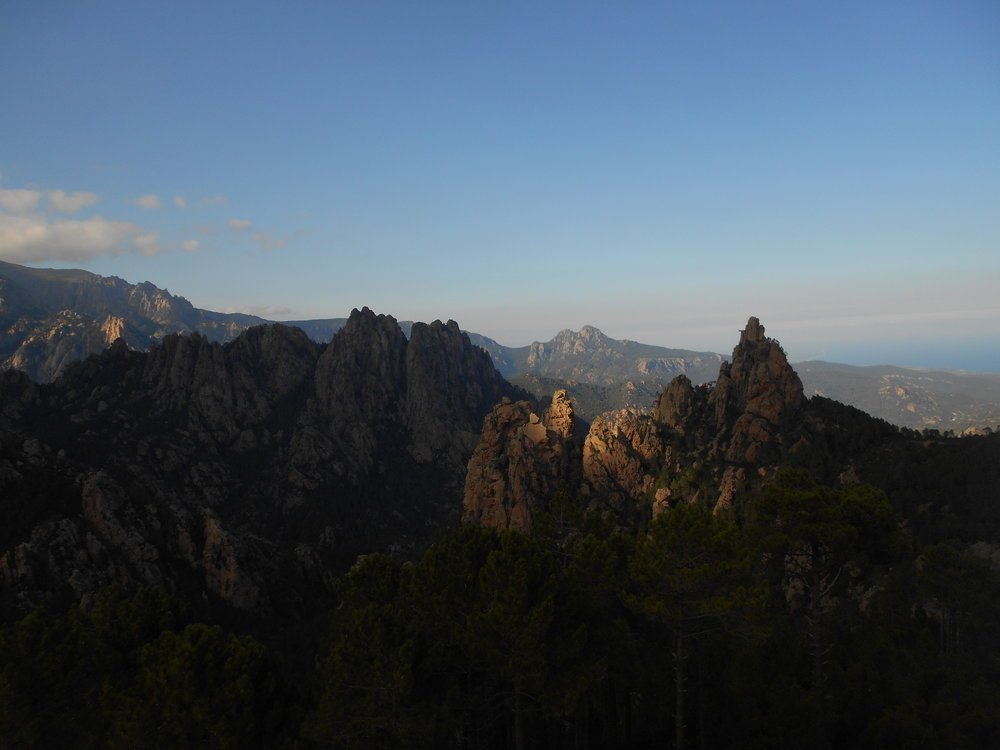
As we were waiting for the supermarket in Calenzana to open we were able to have a relaxed start. Stocked up on gas and fresh bread for our lunch that day we headed out from Calenzana. The trail slowly gains over 1300m of height of height on the first, the town and dry scrubland gradually falling away as majestic granite mountains grow in the distance.
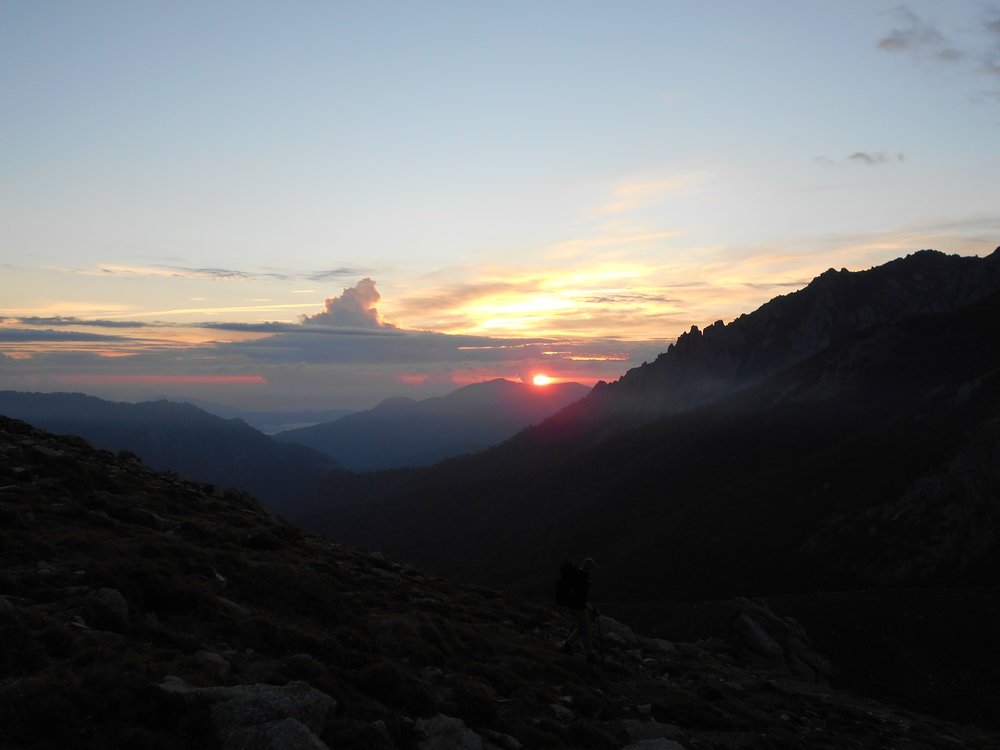
Our first bivvy spot was actually one of my favourites. It was very obvious and approximately halfway along the 2nd section where the trail drops down into a gulley before quickly rising back up again. Some stone walls are guarded by a huge rock (for some reason this strongly remind me of ‘Pride Rock’ in Disney’s ‘The Lion King’!). The rock provides a flat surface for cooking and sun basking on, and even has some rudimentary benches set up! With a stream just a hundred metres away along the trail this was a pretty ideal spot! Clambering round the back of our rock to watch the setting sun I felt very content, I’d been back in the UK between my caving trip and this for 3 weeks and had grown restless. It felt good to be back out in nature again.
Note that you’re not allowed to wild camp on the GR20 so set-up late and practice ‘Leave No Trace’ ethics if you do – we were then in September and never encountered any problems wild camping, this might be different in the busier summer months if rangers are more active. I’m not sure how I feel about wild camping; I understand the authorities’ desire to protect their landscape but for me wild camping is an integral part of the experience. Plus I regularly (rightly or wrongly) wild camp in the UK so it would be hard to justify a decision not to abroad.
Not really believing the good weather we’d experienced yesterday we set out early the following morning to avoid the GR20’s renowned thunderstorms. We soon realised this to be a mistake as we struggled to find trail markings through a wooded section and made slow progress for the first hour or so until daylight broke. Within another day or two we’d realised that regular afternoon thunderstorms were unlikely and so we could probably afford to wait until day break before starting out.
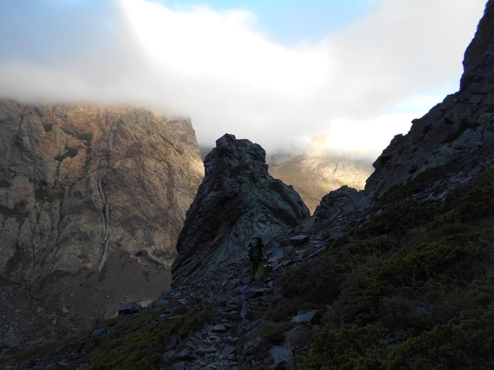
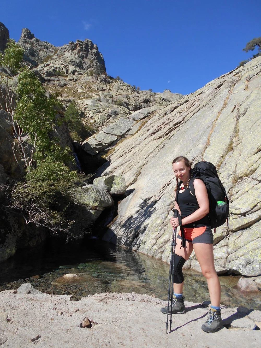
Soon we were past the hut and into the third section, which was probably the most beautiful part of the trail. You soon cross a river using a bridge and then walk up a wooded valley with a beautiful river running on your left-hand side. Some parts of this section were equipped with chains as climbing aids; this was generally for steep slab sections rather than full on climbing/scrambling. Much is made of the scrambling difficult of the GR20 but to be honest I didn’t find it that bad. Harder scrambles were few and far between, short and well equipped with fixed aids. There were more slab moves (where you needed to walk up or down a steep smooth rock) than climbing moves and these would be more difficult when wet – that said, again these were generally well equipped with fixed chains.
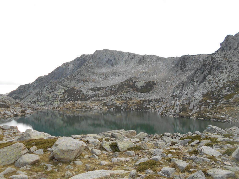
The next few days passed in a bit of a blur. Steep ascents and descents, row after row of granite mountains and ridgelines and crystal clear rivers filled our days. On a misty afternoon on the 3rd day we crossed a large grassy area with a lake, the whole area criss-crossed by small streams and soil pits filled with dirty water from the local horses. Consulting the map I saw that this was the source of the Tavignanu, a river I had paddled on my previous trip to Corsica. Seeing the water quality at this source has made me dubious of all the times I’ve drank seemingly safe river water in the wild – you never know what’s upstream!
After 6 days we descended into Vizzavona, a small village which separates the north half of the trail from the south. Vizzavona is small but there are a couple of restaurants, two small resupply shops (one in the trail campsite and the other near the train station) and the train station. There are also some good ruined buildings for anyone into urban exploring!
We decided to take a rest day and head out to Corte on the train. Food resupplies had been limited and very expensive so we figured that by heading to Corte we would be able to get a wider range of cheaper food. We also decided to buy food for all our remaining days here (to save money) – this didn’t work out particularly well for me as I’d been carrying all the food (as Emily couldn’t fit it in her bag) and therefore I ended up with a heavy pack for the next couple of days!
The trail was noticeably easier after Vizzavona, particularly once I’d eaten some of the food and got my pack weight down. The terrain was less technical, and the ascents and descents were less steep. Emily had jokingly complained how she could still see the sea for the first few days of the trail – we were meant to be walking away from it! The sea had soon disappeared but, on our 3rd day after Vizzavona, the sea re-emerged after we ascended a hill – the end was in sight!
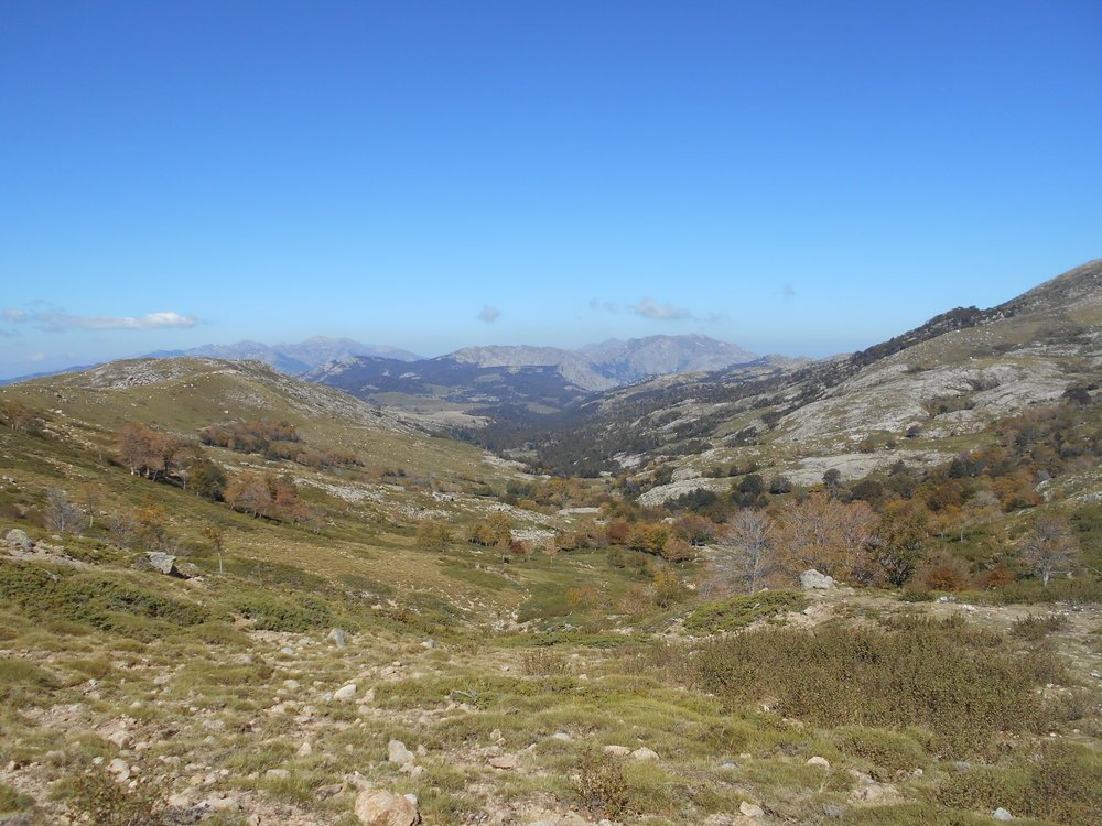
By now the terrain had become less harsh, craggy mountains were replaced by rolling fields and clear mountain streams by babbling brooks. One of my favourite spots came on our penultimate day, walking along part of the trail that felt more like the English countryside than the Corsican mountains. The day had been relatively easy and we’d seen lots of wildlife, include wild boar, and so were both feeling very positive. We’d seen lots of idyllic camping spots but pressed on, eager to stick to our plan so we could have a couple of ‘tourist’ days at the end of the trail. The photo below doesn’t really do this spot justice but I found it to be very serene and beautiful, a gorgeous mix of yellows, greens and browns offset and accentuated by the sound of running water and the cream boulders lining the river bed.
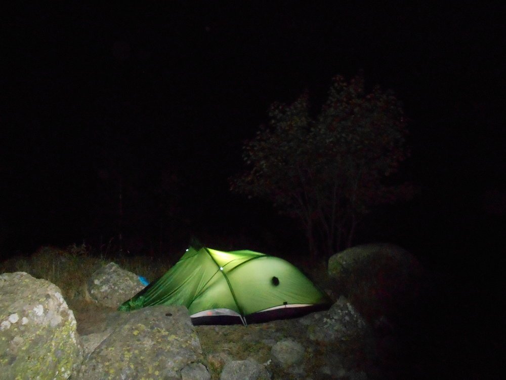
We had bivvied just past the last refuge (Refuge d’I Paliri) so our final day was short. This bivvy was also a good one, set back up in mountain landscapes on a plateau with impressive views all around. Emily set off ahead of me on the final day and was suffering from a knee injury and had slowed down a bit on the descents, I just wanted to finish reading my book! I’m not sure if it was because it as the last day, or because I was hiking by myself, but I found the scenery along this descent to be wild and I felt isolated – it was wonderful. The trail alternated between dense forest, rocky landscapes and dry river beds and we saw more people on this section (presumably day hikers from Conca) than we had typically done on the trail. I caught up with Emily on a long traverse section and we walked the last hour or so into Conca together, it was a surprisingly long way from the end of the trail through the town to accommodation or onward transport, particularly when you really want a beer!